(Photos are from my iPhone and Shreya’s Sony A-6000.)
I went to Norway for 9 days the week before Memorial Day weekend. As is the norm, I was blown away by the pristine beauty of the country, and will certainly go back. There is some great climbing and skiing to be done in Norway in the future.
The highlights for this trip were 3.5 days spent in the Lofoten islands and the Sognefjord + Flåm tour.
I flew SFO-AMS-OSL with KLM and landed in Oslo on the afternoon of May 21, 2016. The TSA was having a holiday and not making anyone take off their shoes or take out their laptops! There were a few moments at Schiphol when I thought I was going to lose my luggage, again! I could see my bag in the vehicle from the terminal, and the guy didn’t unload it at the plane the first time around. Fortunately he came back to deliver that one piece and keep my trip going smoothly.
The Flytoget airport train to downtown is fast and frequent, and you can even pay by credit card directly at the turnstiles. I met Shreya at the station and we went to the Anker Hostel where we had a room. After a nap, it was time to do the most important thing when arriving in a Scandinavian country: buy groceries so you don’t get gouged by expensive restaurants! Pasta, green pesto, bread, cheese, garlic sauce (garlic mayo), baked beans and apples was the first run. Don’t forget the obligatory cookies.
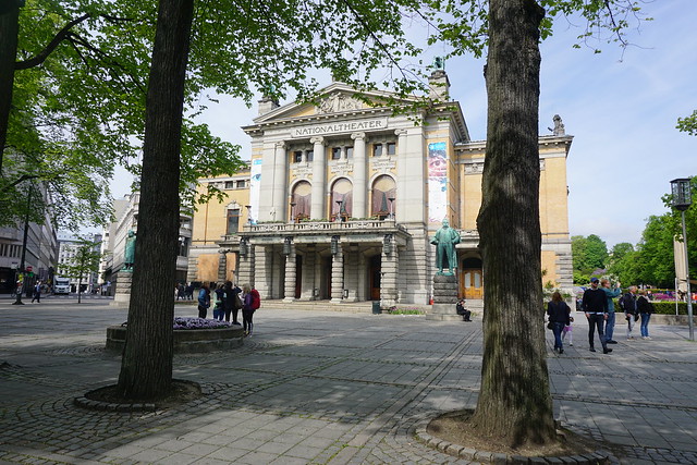
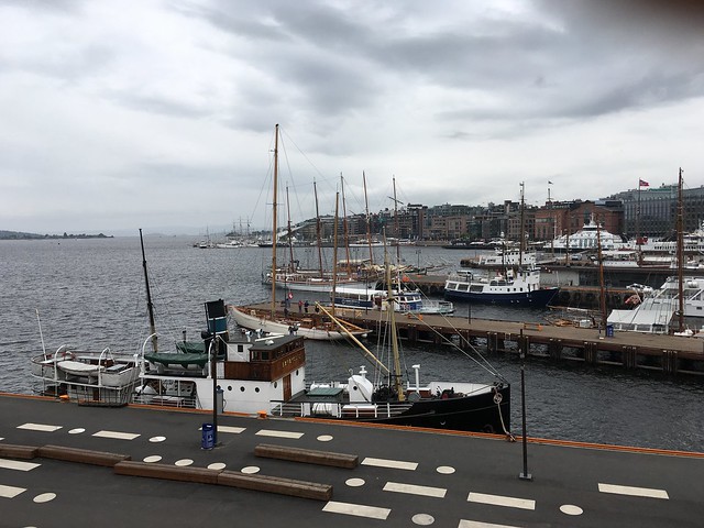
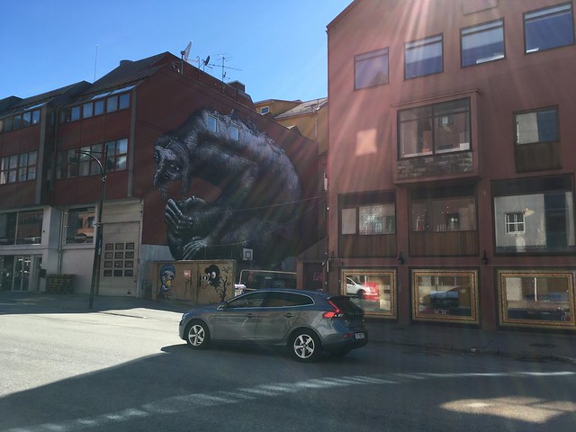
The food taken care of, we proceeded to walk around the center. Oslo is not very interesting architecturally or socially. The colors are drab, and at least on that cloudy day, hardly anyone was in the streets. The opera house is impressive, but very out of place. The sinking ship/glacier is a nice touch though.
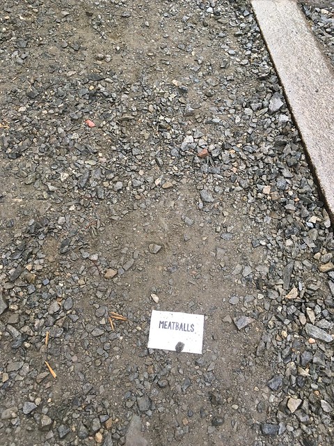
The Norwegians have a different idea of meatballs.
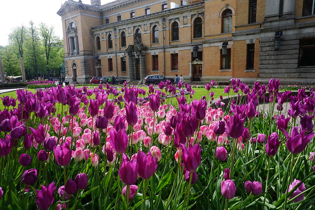
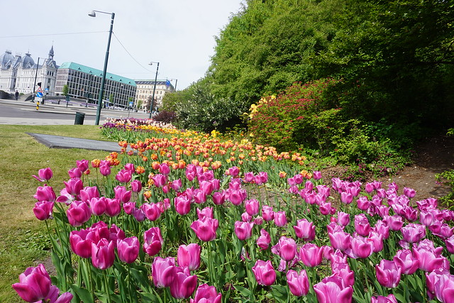
One thing Oslo was not lacking in spring was flowers. They were everywhere, and they were delightful. More of these will show up later.
The Anker Hostel had an in-room range for a pasta dinner. After that we tried to sleep in the weird half-evening light that hangs around this time of the year.
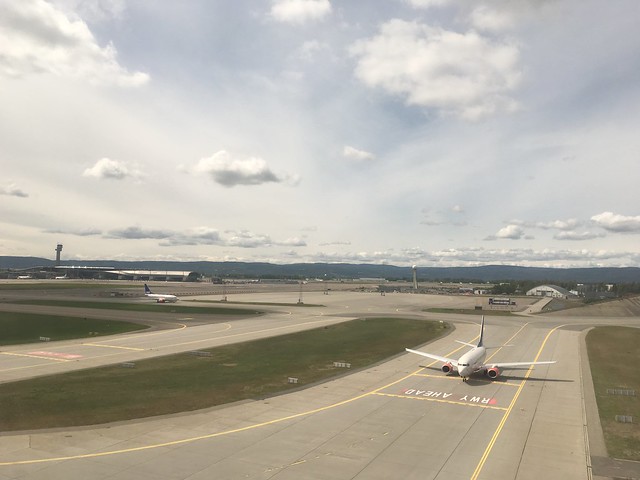
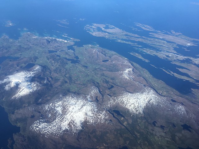
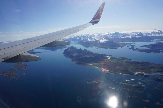
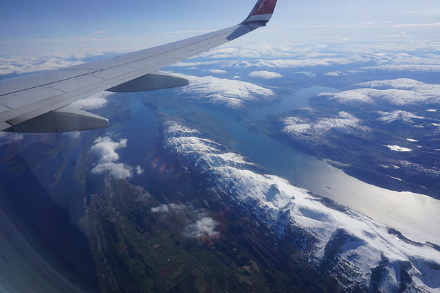
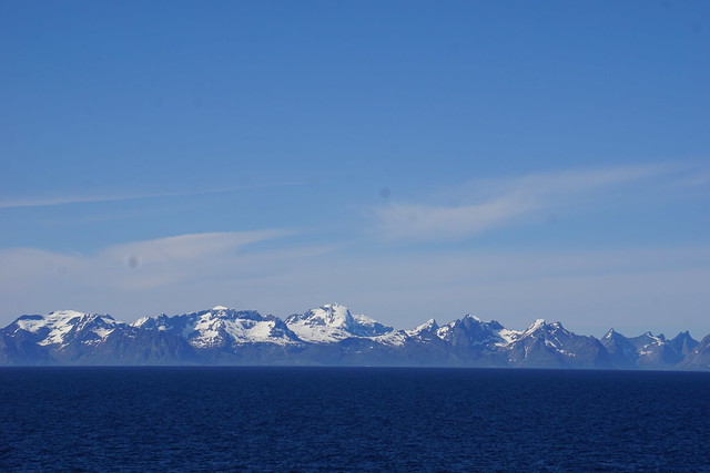
The next morning it was back to the airport to catch an early flight to Bodø. The self-serve bag check was fascinating. I was looking forward to Bodø after this very interesting story about an SR-71 Blackbird landing during the Cold War. Although the story has nothing in particular about Bodø, exotic sounding places in far-off locations have that effect on me. It did not disappoint. About 2/3rds of the way into the flight the weather cleared, and the Real Norway opened up. Blue seas, green islands, and jagged, snow covered mountains. Fish farms, tiny roads that led to single houses in the middle of nowhere (private islands?) and occasional small towns. Even the small towns often had an airfield, a necessity in this fragmented landscape.

Arctic circle crossed!
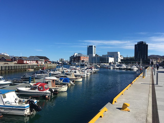
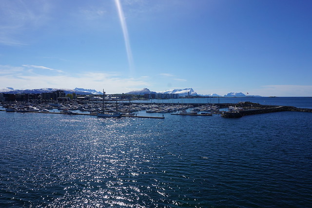
Bodø airport is small and just a 20min walk to downtown. We had about 3 hours for the ferry to Moskenes in the Lofoten. Unfortunately, it was a Sunday. This meant the most happening place in Bodø was the 7-Eleven store.
The 7-Elevens in Norway are nothing like the dingy, gas station places I see in California. This one had a complete frozen yogurt bar, plenty of baked goods and other snacks. It had bright outdoor seating, and had more people (~10) than I could see in the rest of the street. I lost a few more kronor on a warm slice of pizza.
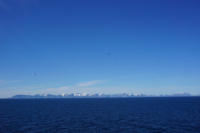
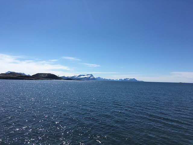
We continued walking down the coastline to the ferry terminal. The air is spectacularly clear so far North. We could see the Lofoten wall across the horizon from a 100 kilometres away.
On the way out to the Lofoten we took the Bodø-Moskenes ferry which departs at 1pm. This is a car ferry. I wolfed through more garlic sauce and bread waiting for the boat. There were a few early risers here with us, and a couple of other backpackers we had seen on the plane.
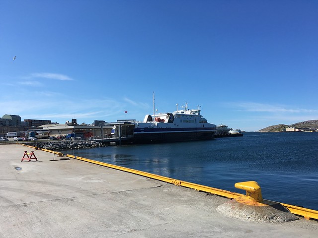
Tickets are about NOK196 and there are 2 decks. We grabbed the upper deck that had the larger chairs around round tables. The boat filled up quickly. There were a lot of kids so far north, boisterous kids no less. While I appreciate the Norwegians letting their kids run around freely, even on a boat, the incessant chatter got old by the time we reached Moskenes.
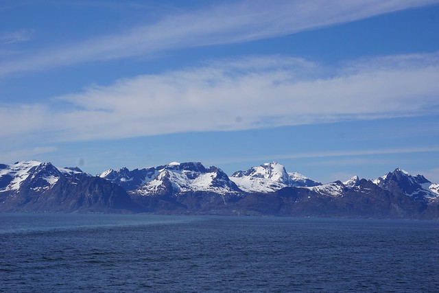
The boat ride was scenic, windy and listless, in that order. Every few minutes we would head out to get over the lethargy, take a few pictures, then be forced back in by the wind.
The ferry navigates around the twin islands of Little and Big Hjartøya and spills out onto the Norwegian Sea.
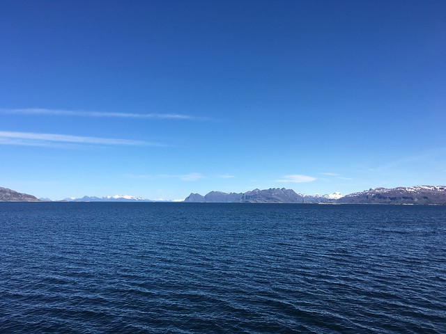
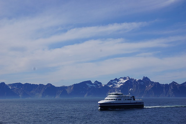
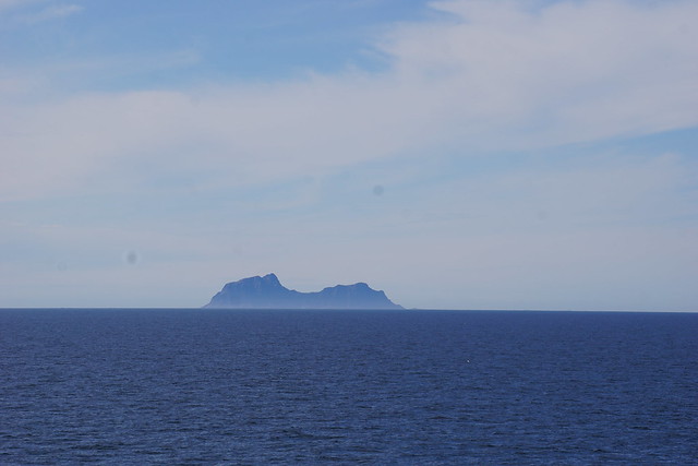
The Lofoten Wall stays constant, and the small islands of Røst, Værøy and Mosken dot port side.
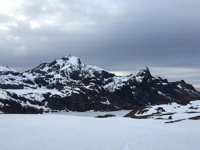
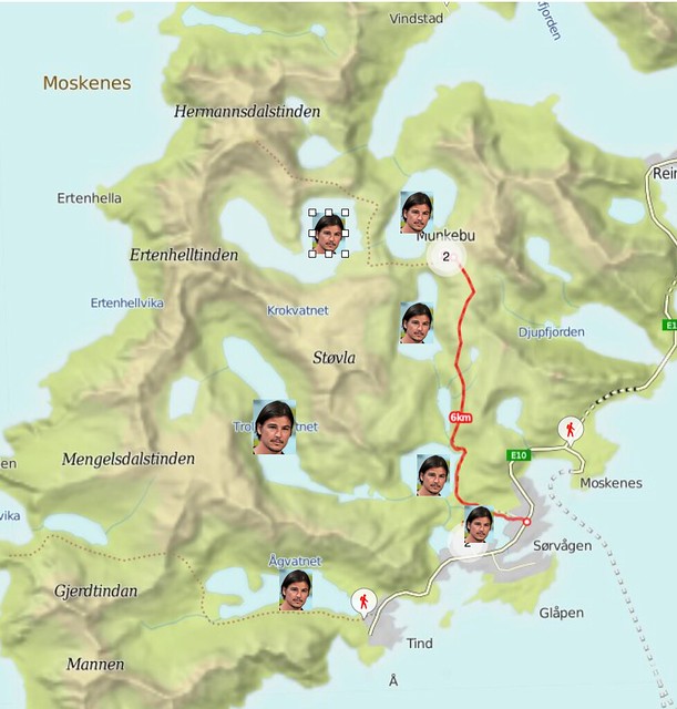
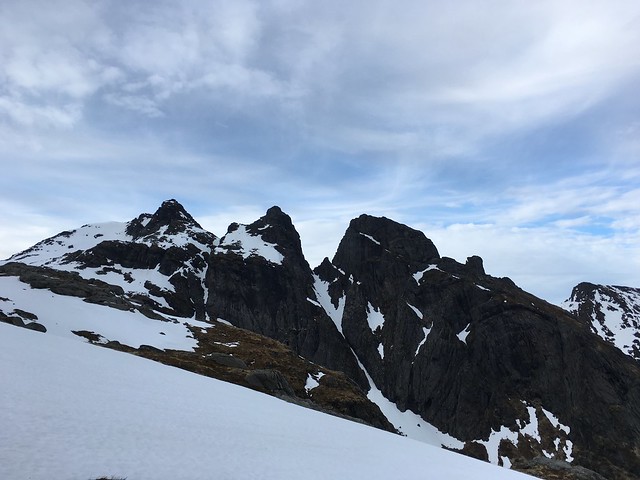
As Moskenesøya became more clearly defined, we tried to figure out where our hike would take us. That’s right! Within 24 hours of having flown across the atlantic, crossing Norway and taking a boat out to a place most people haven’t heard of, we were going to backpack 5 kilometres into the wilderness and leave our hopes to the snow gods. They were not ready yet, as all the higher summits still had plenty of snow. The original plan had been to summit Hermannsdalstinden, but we weren’t foolhardy enough to try a 40 degree slope in tennis shoes and no other gear. We would have to be content with hiking in to the Munkebu hut and spending the night there.
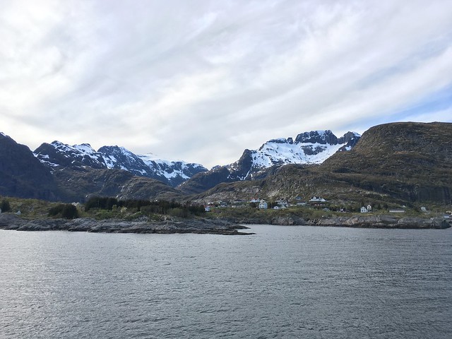

The ferry touched down at Moskenes at 4:30pm and we started walking west. It is 2km of walking along the E10 to the town of Sørvågen. The road is narrow and the shoulder fits only one person, but everyone drives slowly and walking along the road is acceptable and expected. The seaside is spectacular, and the mainland was still visible. The weather was reasonable, temperatures must have been in the 5-10C range, with only a slight breeze.
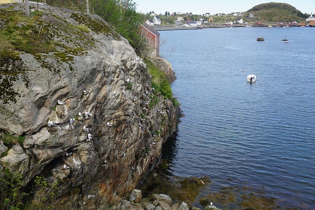
The hike to Munkebu hut begins from the lake called Sørvågvatnet in the town centre. A trail goes around the lake, and the eastern entrance is from the lane to the post office. Turn right here and the proceed down the street to reach the beginning of the trail. We made a couple of wrong choices and had to cross a few people’s backyards to get back on track, but generally head towards the lake and you can’t miss it.
Before we start hiking, one thing has to be made clear so Norwegian words don’t keep tripping you up.
More seriously, vatnet is lake, and tind is pinnacle, but in Norwegian, pinnacle is used the way we use peak.
We encountered several people near the lake, including two cute, tiny girls and their dog, who told us which way to go when the trail got boggy. At least in the Lofoten, the water from all freshwater sources is safe to drink and I filled up along the trail. The residents of Sørvågen actually use the water from the lakes we would be hiking along and there are signs forbidding swimming in these lakes.
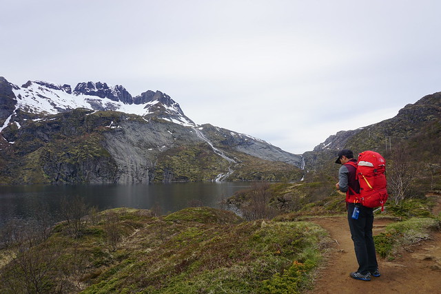
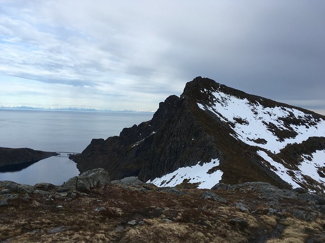
The hike skirts several lakes, gaining most of the elevation at the beginning and the end. It is 5km and about 600m (~2000ft) uphill. The lakes and mountains are breath-taking, from oblong Tindalsvatnet to glittering Fjerddalsvatnet.

The trail tends to stick close to some lake, then suddenly go uphill, leaving you hundreds of feet above another lake. Several sections of trail were boggy, and no attempt had been made to engineer a nicer trail, leading to lot’s of footpaths. I guess they don’t have enough traffic yet to worry about erosion. We ran into a small group at Fjerddalsvatnet, and a solo hiker halfway up Djupfjordheia. He had tried to ascend Munken, but given up due to sketchy snow almost at the top.
The section along Lake Tindal and Fjerddal is incredibly scenic and also flat. The final obstacle is cresting the hill called Djupfjordheia. Several factors made this painful. One; jet lag and travel fatigue was starting to catch up, two; we were encountering patches of snow, leading to cold feet, three; the clouds had started moving in for a while, lessening the wow factor and finally, something I call the Metric Map Paradox.
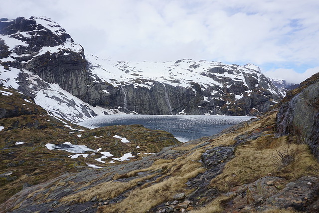
In the USA, maps use miles and feet for distance and elevation. The sane world uses kilometres and metres. Unfortunately, a mile is greater than a kilometre, but a foot is less than a metre. This means that European maps are stretched horizontally, but compressed vertically. My lizard brain was interpreting this as making quick progress on the horizontal. On the other hand, Djupfjordheia, which looks so short on the map, presented three false summits and never ended by feet standards! We were relieved more than anything to be on top and able to see Munkebu hut. Our spirits did rise a little at the incredible views that opened up!
From here, it was another kilometre of slogging through snow to Munkebu hut.
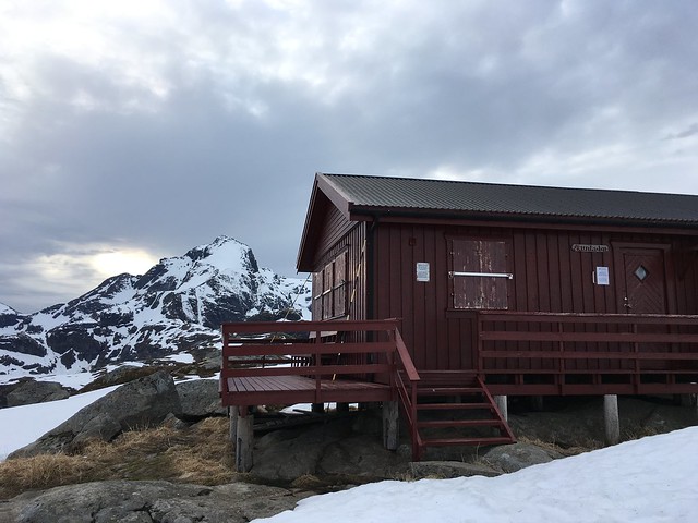
Since the hut was closed and no one else was around, we pitched the tent right on the hut patio, to give us some insulation and convenient flatness. Water was available from tiny melted out sections of the lakes next to the hut. It was fun to just dip my bare hands in icy water to fill the bottle and transfer it to the MSR Dromedary. Most of the time, having a high metabolism is a blessing.
Dinner was garbanzo beans, bread, and… garlic sauce!
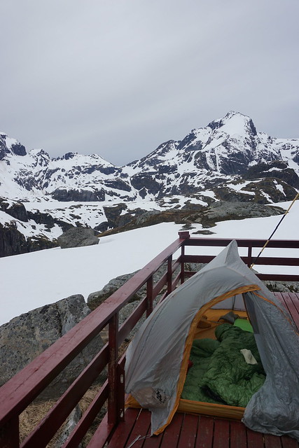
We reached the hut around 8pm. Between reading 1632, eating cookies, dealing with a noisy tent, and incessant light, sleep did not come around till midnight. The sleep deprived arctic adventure was off to a great start!